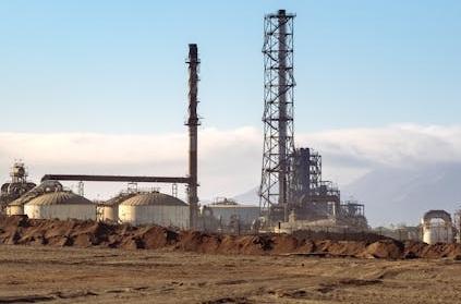
A phase 2 land contamination assessment is an investigation performed on a site to determine the nature and level of contamination of the site. A phase 2 land contamination assessment is usually done when a phase 1 desk study indicates that the site could be contaminated. In case you are looking for a phase 2 land contamination assessment report or a contaminated land risk assessment example, here is a sample you probably want to read. This report is a phase 2 land contamination assessment gas work site Aberdeen example. This phase 2 land contamination assessment sample is for a gas works site that is to be converted into a commercial development. Here is a free phase 2 land contamination assessment Aberdeen report preview. You may also download the complete report in pdf.

Phase 2 Land Contamination Risk Assessment
Background
This report presents the outcomes of a phase 2 land contamination assessment conducted for a gas works site earmarked for conversion into a commercial (light industrial) development in Aberdeen, London. Following recommendations from a phase 1 land contamination assessment that indicated high risks of soil contamination by various chemicals, a phase two assessment was carried out. The phase two assessment involved an intrusive investigation, encompassing the collection and analysis of soil samples from the site. Soil samples were obtained from 10 randomly selected locations across the gas works site and subjected to laboratory analysis.
Situated within an industrial area, the site covers an area of 150m2 and has a trapezium shape with a gentle west-to-east slope. It comprises three pits where large underground gas storage tanks had been removed, residential houses, a main operational area, and gasometers (Gas Works Aberdeen, n.d.). The gas site, once used for storing petroleum products and natural gas, has been inactive since its official closure in 1950. The surrounding area is utilized for light industries, railways, boreholes, a school, residential flats, playground, and a railway. The site is bordered to the west and north by a road running diagonally in the same direction. To the northeast, it is adjacent to light industries. A road borders it to the south, while retail shops line the eastern boundary (Gas Works Aberdeen, n.d.). …
Download the complete phase 2 land contamination assessment Aberdeen pdf.